
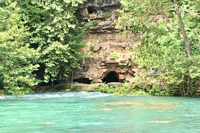
The National Park Service (NPS) has announced its Roads and Trails Management Plan for trails and recreation areas in the Ozark Scenic National Riverways. Its goal as stated by NPS, is to “improve park roads and trails to ensure that it provides access to a variety of locations and experiences while also protecting the park’s fundamental resources and values.”
NPS says that includes restoration of undesignated trails to protect the park’s natural and cultural resources and improve visitor safety, including the preservation of historical structures and native plant and animals species along trails. Easier, faster access by law enforcement and search and rescue teams during emergencies was noted as a further reason for the closure of undesignated trails, along with cost savings and more investment in designated visitor facilities in parks.
The goals for the future of the park, which have been under advisement and study since 2015, included public input through submitted commentary and in-person meetings, analysis of natural resource and visitor impact, and the consultation and advice of eight affiliated Native American tribes, the US. Fish and Wildlife Service and the Missouri State Historic Preservation Office.
ONSR Chief of Interpretation, Planning and Partnerships Dena Matteson told the Quill the project will begin this winter with surveys to finalize trail routes. The entire project is expected to be completed over the course of three to seven years, she said, funded with money coming mainly from various federal sources. Improvements will be planned in phases to minimize visitor impact, Matteson added.
Camping; facilities, parking and waterway access; and the use of trails for pedestrian, bicycle, ATV/UTV and horseback riding were taken into consideration during the planning process.
THE CHOSEN PLAN
The second of three options considered, designated Alternative B, provides for 216.5 miles of public use roads, the closure of all undesignated roads to return to a natural condition and the closure of about 14 miles of designated NPS-managed roads that are duplicate routes, in unstable or impassable condition, or a threat to resources.
In addition to existing designated trails, 49.5 miles of new trails will be added, including 7.5 miles in agreement with private landowners outside NPS jurisdiction, for a total of 150.5 miles of trails. NPS added that formal agreements with private landowners will be secured before any trail development.
According to this plan, biking will continue to be allowed on designated park roads and about 10 miles of designated bike trails will be added.
For horseback riding under this option, NPS intends to establish a permit system for individual riders, in part to provide education and information to riders, document the volume of use and manage use in order to reduce congestion on the trails. Any use fee charged will support trail maintenance and administrative costs for the permit system.
A new hiking trailhead and a horse staging area will be built to accommodate horseback riders. Seven designated horse trail river crossings will remain open and seven new crossings designated, with the requirement that horseback riders cross the river only at the designated crossings.
The effects of horseback riding on plant life and river water turbidity at crossings were considered when making the plan “to reduce potential impacts on water quality and sensitive species,” according to NPS.
Similarly, ATV and UTV use will be restricted to designated NPS roads through a permit system, with any fees collected to be used for maintenance and cost recovery.
Under Alternative B, three recreation areas will be removed because of the closure of NPS-administered access roads, with 94 designated recreation areas with river access remaining. NPS added that future updates to river use management may alter the number of recreation areas along the river.
As in Alternative A, visitors using motorized and nonmotorized watercraft will still be allowed to camp on gravel bars at least a half-mile from a designated campsite and more than 50 feet from a designated recreation area, with a designated camping area established on the Log Yard gravel bar. Gravel bar camping will also be allowed at designated campsites at Two Rivers and walk-in camping at some gravel bars formerly accessible by vehicle. Designated parking will be established nearby where vehicles are prohibited.
ALTERNATIVE PLANS
Two other options were considered, including a plan for no action. That plan entailed continuing current management and removing undesignated trails with no new roads, trails or associated facilities added. However, it did include accessibility improvements at park sites, including Alley Spring Mill and Schoolhouse, Big Spring, Round Spring and Two Rivers campground and amphitheater. The first option, Alternative A, included 230.5 miles of designated public use trails, roads and river crossings.
Undesignated trails are described by NPS as those created by visitors, and includes about 90 miles of trails, many of which the NPS describes as not meeting acceptable trail standards because they have not been properly sited and constructed.
Alternative C would have closed 13 miles of NPS public use roads, expanding opportunities for recreational activities comparable to Alternative B, with nine more miles of trails, two more river crossings and one more recreation area. Under that plan, 58.5 miles of new trails with 7.5 miles outside NPS jurisdiction added.
New biking opportunities would have been added under Alternative C, and permits for horseback riding and ATV/UTV use would be the same as Alternative B. Horse trail river crossings would be closed in undesignated areas, with seven designated crossings remaining open, and nine additional crossings opened instead of seven, for a total of 16 designated crossing points.
There would have been one less recreation area under Alternative C, with the closure of Summer’s Bluff Primitive Area. Horse staging areas, parking areas, trailheads, vehicular access to gravel bars and accessible routes and trails would have been the same as Alternative B.
Actions that were considered but rejected were to allow free-range horseback riding, designating all current undesignated visitor-created trails for use, closing all designated park roads and opening all trails to bicycle use. Those actions were dismissed as not meeting the needs of the plan, unable to be implemented for technical or logistical reasons or “not consistent with the purpose or significance of the park.”
The selected plan is not considered to have a significant effect on the human environment, according to NPS, but is expected to bring the benefit of long-term positive impacts on visitor experience and safety, increased access and resource conditions.
Links to full documents and analysis regarding the plan may be found by clicking here, then clicking on “Document List” in the menu on the left side of the page.


