
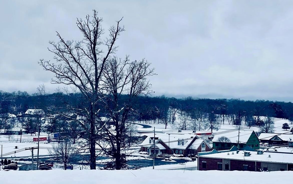
Citing both continued poor road conditions and power outages, West Plains R-7 Schools announced a third snow day for today; with R-7 being out of session, all surrounding rural schools in consortium with the district are also out of session. As of press time, Richards School, not in the consortium, had not announced a decision.
West Plains R-7’s decision was announced at about 11:30 a.m. Thursday, and was the first area school closure to be announced that day.
Dora School District announced about half an hour later it would also not be in session Friday, and that, for the second day, it would open the FEMA (Federal Emergency Management Agency) building on campus for any family still without power. The building was first opened Thursday morning for that purpose, due to many families in the area being without power for nearly 48 hours, according the the district’s social media. Bakersfield School District has likewise opened its FEMA building for those without power.
Viola School District in Arkansas also announced it would be closed, and students in that district will have their second day of alternative methods of instruction. Alton School District will also not be in session today due to road conditions.
As of 2 p.m. Thursday, the Missouri Department of Transportation Traveler Information Map was showing unknown road conditions for most state highways in the Quill’s coverage area; U.S. 160, 63 and 60 area all fully cleared, as well as CC Highway west of West Plains to AD Highway, K Highway west of West Plains to County Road 6470 and Highway 17 south of West Plains to the Arkansas State Lane.
While power has been restored to all customers served by City of West Plains Utilities, 9,200 Howell-Oregon Electric Co-op members — a third of the co-op’s membership — were still without electricity as of noon Thursday, said officials. The number is rapidly dropping; at 2 p.m. Wednesday, more than 13,000 members remained without power, and by 7 a.m. Thursday, power had been restored to 2,000 more members.
“Crews from five different Missouri cooperatives arrived by last night, giving us 39 additional linemen and 16 contractors to assist our HOEC team to continue working on the restoration,” Howell-Oregon Member Communications Specialist Stephanie Beltz-Price told the Quill. “All linemen gathered at HOEC in West Plains early this morning for a safety and job briefing before tackling today’s task.”
She once again expressed gratitude to members for their patience, adding that crews continue to work across the service area today to resolve outages scattered across HOEC’s system, battling against mud, fallen trees and slick roads to make repairs.
In West Plains, a dozen crew members worked nonstop from 2 a.m. to 4:30 p.m. Wednesday to restore power to a total of 1,467 customers said city Public Information Officer Cody Sanders. Those outages occurred over five separate instances, and the most reported at one time was 1,205. Sanders noted the primary issue was the weight of the snow, which had a high water content and weighed down tree limbs so that they were resting or falling onto power lines. Three primary lines were downed as a result of the storm, four poles were damaged and one transformer had to be replaced, he added.
Beltz-Price reminded members of the public that if a downed power line is encountered, it should be treated as if if it is energized and avoided. To report downed lines or outages in the co-op area, call 417-256-2131 or 888-HOE-POWER, make a report via the SmartHub mobile app or go through the website at www.hoecoop.org. In side West Plains city limits, downed lines may be reported by calling city hall during business hours, 8 a.m. to 4 p.m. weekdays, at 417-256-7176, or call the police station after hours, 417-256-2244.
The National Weather Service office in Springfield expects rain to develop Saturday evening through the area, and with it, the possibly of mixed wintry precipitation forming in the tail end of the weather system Sunday morning. With temperatures today and Saturday expected to be in the upper 40s to lower 50s, Sunday will see some slightly cooler weather with highs in the mid-40s.
More precipitation is expected to impact the area Monday night into Tuesday evening, with the possibility of freezing rain, though confidence in the type of moisture is still low. Temperatures are expected to range from lows in the teens to highs in the 20s or lower 30s through the coverage area.


